Airports, cruise terminals, and working waterfronts move enormous volumes of baggage, cargo, and supplies across large, complex, rule-governed spaces every hour of every day. The vehicles doing that work — baggage tugs, belt loaders, cargo transporters, deck handlers, and barge operators — increasingly need to operate autonomously or semi-autonomously to keep pace with throughput demands. Beluga Navigation Systems provides the digital navigation layer that makes autonomous operations in these high-stakes, mixed-traffic environments reliable, safe, and deployable without overhauling existing infrastructure.
The Navigation Challenge in Transportation Hubs
Airports, cruise ports, and maritime terminals share a common set of navigation hazards: restricted zones that change with every aircraft stand assignment or vessel berth, pedestrian and vehicle traffic that mixes freely on the same pavement, low-visibility conditions from jet blast, fog, rain, and nighttime operations, and extreme pressure on cycle times where a missed turn or wrong gate costs real money.
GPS is too imprecise for the apron and too unreliable near large metal structures and jetways. Vision-based navigation systems struggle with the reflective surfaces, variable lighting, and cluttered backgrounds of an active ramp or terminal quay. Beluga’s BIDAR™ protocol provides the precise, infrastructure-based local guidance layer these environments need — active digital beacons at every decision point, communicating directly with vehicle navigation modules in real time.
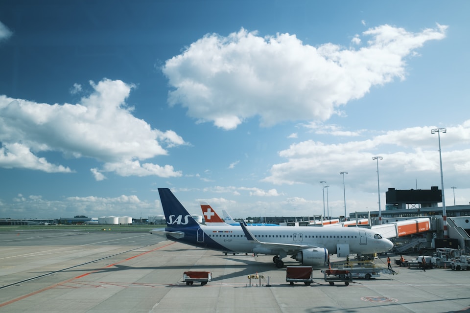
Airport Baggage & Ground Support
The airport ramp is one of the most demanding autonomous vehicle environments in existence. Stand geometry changes with every turnaround, towbar connections must be aligned to within centimeters, and the cost of a ground incident is measured in aircraft damage, flight delays, and injury liability.
- Autonomous baggage tug trains — navigate from baggage make-up to aircraft stand and back on fixed digital corridors, receiving stand-specific docking instructions from GRGuides at each gate
- Belt loader and ULD transporter positioning — align loading equipment with aircraft hold doors using millimeter-accurate GRGuide position fixes at each stand, eliminating the manual alignment step
- Baggage claim sortation routing — guide autonomous carts from inbound belts to correct claim carousel positions in below-wing and landside areas
- Fuel vehicle and catering truck routing — enforce speed limits and directional rules on taxiway crossings and service roads with GRGuide beacons that update dynamically as stand assignments change
- FOD detection vehicle routing — ensure full systematic ramp coverage with precise path-keeping on runway and taxiway inspection passes
Cruise Ship & Passenger Terminal Operations
Cruise terminals handle thousands of passengers and tons of luggage in compressed turnaround windows, often with vehicle and pedestrian traffic sharing the same quayside apron. Autonomous baggage and supply vehicles operating in this environment must navigate around gangways, passenger boarding bridges, and provisioning equipment that move between every call.
- Quayside baggage transport — route autonomous luggage vehicles from terminal check-in to shipside loading stations, with GRGuides at each vessel berth position providing precise docking alignment
- Provisioning vehicle guidance — direct supply trucks and electric cargo vehicles through terminal yards and onto the correct berth approach without relying on painted lane markings that wear quickly on salt-exposed concrete
- Gangway alignment assistance — provide GRNav-equipped gangway positioning systems with precise vessel-relative location data to automate the final approach and seal
- Passenger mobility vehicle routing — guide electric shuttle vehicles and mobility assistance carts along fixed terminal corridors shared with foot traffic, enforcing speed and priority rules at each intersection via beacon commands
Maritime Barge & Waterway Logistics
Inland waterway barges and short-sea coastal vessels operate in narrow channels, congested lock approaches, and busy river terminals where precise maneuvering is essential and margins are tight. Unlike ocean-going vessels with long response times, river barges and push-tow combinations maneuver frequently and at close quarters — exactly the operating regime where BIDAR™ Mid-Range and Short-Range guidance delivers the most value.
- Lock approach and chamber entry — GRGuide beacons at lock entrances communicate chamber length, current occupancy, and required approach speed to incoming barge combinations, enabling automated deceleration and alignment
- River terminal berth approach — guide loaded barges to precise mooring positions alongside conveyor heads, crane legs, and pump stations with centimeter-accurate position fixes
- Fleeting area management — deploy temporary GRGuides to define active fleeting lanes and exclusion zones that update as fleet arrangements change, without requiring channel remarking
- Push-tow navigation on constrained waterways — provide towboat pilots with digital advisories at bridge approaches, bend entries, and crossing points where channel width limits recovery time
- Automated fuel barge positioning — guide bunkering barges to precise alongside positions on vessel-specific fuel manifold locations to minimize hose handling and spill risk
Integration
GRNav integrates with vehicle control systems via serial interface and is compatible with the ground support equipment (GSE) control protocols used by major airport vehicle suppliers, as well as NMEA and proprietary interfaces common in commercial waterway vessels. For terminal operators managing mixed fleets under a central operations system, GRGuide beacons can be updated remotely in real time to reflect gate reassignments, berth changes, and dynamic routing decisions — giving the operations center direct influence over vehicle behavior on the ground.
Evaluating autonomous ground support, terminal logistics, or waterway navigation for your operation?
Contact Us →